(hover over the pictures to see captions, or click on the first one of each set to scan through them in full size)
_______________________________________________________________________________________________________
On the morning of the 9th of May, at 0530! We’re waiting in the dark on an empty Igoumenutsa dockyard for the ferry to Venice..
Soon a couple more hopefuls turn up and by 0630 the ferry is here. It starts it’s journey at Patra (North West Peloponnese), where it seems, the majority of people get on. With a bit of manoeuvering, we’re in our spot on the ‘open deck’, and plugged in to free onboard electrics. Glad I’m not driving the artic’s that will have to reverse back down the ramp, with mm to spare, when we disembark! The weather’s fine and it’s a smooth crossing. We find we can sit in a patch of sun on the car deck and stay out of the wind and away from the smell of diesel and fried food on the upper decks. It’s certainly a very effortless way to cover around 500 miles (and the overland distance is a whole lot more). Every now and then we check our position via a mapping app. on my phone – the captain seems to know where he’s going J

are you sure this is the right spot?

Goodbye Greece

An easy 500 mile ‘drive’
It’s a beautiful calm and sunny morning as we arrive in Venice. They’ve recently changed the route in and unfortunately we no longer go anywhere near the old city. It’s just visible in the distance beyond the miles of fish traps and lagoons.

the pilot arrives

Venice lagoons at sunrise

NOT such an attractive route into the New docks
As we leave the ferry terminal, we immediately notice how busy everything seems …and organised – there’s road markings: bus lanes, bike lanes, and signs and parking meters. We’re definitely not in Greece anymore! We head out onto one of the thin strips of land that form the final barrier to the sea here and manage to find some free parking (there’s very little of it!) at Punto Sabioni. It’s all madly busy compared to what we’ve got used to. There are loads of huge campsites and bungalow parks here, and importantly a ‘vaporetto’ stop (the water busses that take you to the various islands of Venice). Having shelled out a fortune on tickets for the next 3 days (2 x 40eu + 3eu for a map), we find a spot by the river/canal and read and watch the many! boats go by for the afternoon.
We spend the next few days exploring Venice and the surrounding islands. It’s an amazing place and unfortunately, SO busy. luckily you can see a lot from the vaporetto, and we make good use of our ‘go anywhere’ tickets. It’s also VERY expensive – we payed 24eu each for a multi museum pass. They last for 6 months, so would be reasonable value if you could make use of them for that time – but then you’d need to keep shelling out for the water busses. We visited the famous Doge’s Palace, the Correr Museum and Mocenigo’s Palace – All housing hugely impressive paintings, sculptures and other works of art; the importance and significance of which, being mostly lost on us. The majority of the paintings are allegorical and unless you understand ‘what’s going on’, they all become a bit ‘samey’. You really need to be a bit of an expert. We’d been warned not to buy anything to eat or drink in, or near, St, Mark’s square, but were still charged 9 euro! for 2 coffees in an apparently insignificant spot – argh!

Approaching St.Marks square on the water bus.

Everything! comes and goes by water here. An unusual UPS delivery truck!

Inner courtyard of the Doges (Duke’s) Palace.

St. Marks bell tower

Queues to get into the Cathedral – argh!

Very elaborate ceilings and endless impressive paintings in the many rooms of the Doge’s Palace

They’re all alogorical. This is ‘Venice’ on the right, taming and plundering the seas, represented by Neptune on the left. (And that’s an easy one!)

Travelling up the Grand Canal on the ‘vaporetto’

Godolla traffic jam

Never seen a ‘4’ rowed like this before!

the famous Rialto Bridge joining the 2 halves of central Venice

More ‘Grand Canal’

Surprisingly modern looking 18thC glass chandeliers in Moncenigo’s Palace

A huge variety of stunningly painted ceilings – don’t fancy the decorator’s job here!

The ‘Bridge of Sighs’ – but is that from the prisoners as they glimpse their last bit of light as they pass over it from the Doge’s Palace to the jail on the other side …or is that from the lovers passing under it in a Gondala? We will never know.
We enjoyed wandering the tiny back streets. We discovered the market (the fish section was particularly impressive) and we even managed pizza and wine in a quiet square without completely breaking the bank.
We popped into several of the old churches and joined the other queuing hordes for St. Mark’s Cathedral. The ceilings in St. Marks are all done in tiny mosaics with a propensity of gold, but although they are probably more unique, after the highly painted Orthodox churches of Greece and Eastern Europe, we found it rather disappointing after all the hype.

Venetian traffic jam

Pizza for lunch in one of the quieter squares

It’s single file for a lot of the Venice backstreets

all seems a bit grey and drab after the Greek churches

colourful market

excellent fish selection!

don’t fancy catching him!

deliveries in Venice are not easy!

above the doorway into St. Marks Cathedral

Gold mosaics inside the Cathedral

I was more impressed with the fancy flooring in a variety of 3D effects..
A day on the island of Burano, with it’s brightly painted houses was a nice change from the hubbub of the main city. We had lunch out here too – being surrounded by lagoons full of fish; fish and shell-fish are specialities. Here we also discovered a restored walled garden, planted with flowers and vegetables and vines, as it would have been when these islanders were self-sufficent. I’m surprised they didn’t struggle for fresh water in the middle of a salt-water lagoon.

Colourful Burano
We spent a few, rather more relaxing, days based near Punto Sabioni, finding some free, allocated motorhome parking (surprisingly along the road outside a campsite) and later a beach carpark with no parking restrictions. The area is completely flat with many marked cycling routes and we explored more on the bikes in the warm wind. It reminds us a lot of Holland, with fields divided by canals and quite a bit of ‘reclaimed’ land; below sea level. It was quiet and peaceful as we headed out along dykes into ‘lagoon land’; home to lots of wading birds.

Free, allocated parking – a rarity in these parts.

out into ‘lagoon land’

ideal for cycling with several marked routes..

Holland? surely!
On Saturday 16th of May, we head off towards Lago di Garda (Lake Garda). It’s very busy on the roads and we pass seemingly endless industry and huge shops, interspersed with some agriculture. Roundabout follows roundabout on badly surfaced roads (we’re avoiding the motorway tolls). Traffic flow seems fast; it’s a rough ride for Heidi. We comment on the neatly clipped verges, trees cut back from the road and relatively fresh road markings. Again; it’s not Greece! We stop for water and a loo empty at Soave, home of the wine, at an official ‘sosta’ (like the French ‘aires’), before continuing to another one right on Lake Garda. There are free motorhome services here too, but they’re charging 15euro! to park for 24hrs and it’s packed. So is everywhere here. The many campsites seem full too. We stay at Garda for a couple of days, discovering a small free carpark 10 mins walk from the lake front on our second night. It’s a lovely spot, and we enjoy swimming in the lake and wandering along the lakeside path between Garda and Bardolino, bringing back memories of 15 years ago when we spent holidays here in a tent, two summers in a row. We decide it’s got overly popular and too busy for our liking now though, and escape to the other (West) side, which is less busy at the moment, before continuing to Lake Iseo to the West.

Peaceful Lake Garda if you’re up early..

…

The Carpark tells a different story!

Cafe / Restaurant lined streets at Bardolino

and busy tourist shops at Garda town

Classic car rally at Garda

Lunch overlooking the lake – well, if you insist 🙂
We continue to be shocked at how built up and busy everywhere is in these parts, and there seem few attractive places for us to stop. There are a lot of tunnels through the mountains, and the sat-nav struggles to determine whether we are above or below ground, more than once asking us to turn off at a roundabout somewhere far above us. The smaller roads really are tiny too, and although they have ‘no lorries’ signs, there are, unhelpfully, no size or weight restrictions. This normally means it’s fine for us, but not around here! With little information, we choose a small car park by a bridge over a river, at Sarezzo, which turns out to be in an industrial estate, for lunch, followed by a lakeside carpark on a point sticking out into the lake at a place called ‘Castro’ at the North end of Lake Iseo; you’d guess an attractive spot with surely a castle, wouldn’t you? No, it’s dominated by heavy industry with no sign of a castle. At 9pm they were still crashing and banging (steel on rock or vice versa, it sounded like). Surely they don’t do it all night, there are a lot of (ugly) flats very close too. We moved to the other side of town and had a relatively quiet night in the harbour / marina carpark, before heading North, up the valley, towards the high Alps.

looking down Lake Iseo from the unattractive industrial town that has no right being called ‘Kastro’

the road round the NE of the lake – too low and narrow for a Heidi – I bet the Greeks wouldn’t have bothered with height and width restrictions!

that’s snow up there …and our intended road goes a lot higher!
The weather deteriorates now – that’s the trouble with mountains – and we have heavy rain and there’s a fresh sprinkling of snow at any height. It all comes as a bit of a shock, having got used to the heat. We dig out trousers and socks! and fleeces, and even resort to heating! This was not the plan! We consider the pass above Tirano as our route into Switzerland, but change our mind as the grey clouds descend. Instead, we head West again, towards the top of Lake Como, half way down it’s west side to Menaggio, and West again, on the SS340 to Porlezza at the top of Largo di Lugano. Como looked attractive, but was madly busy on the only road around it’s edge and we saw nowhere for us to pull off and stop, other than directly into a campsite. Porlezza was thankfully quieter, with several car parks and even one without time restrictions – a rarity in these parts! It’s an attractive place with some parkland alongside the lake. We could have easily lingered.

Porlezza – looking down the lake towards the Swiss border
In the morning, we drive a short distance along the lake shore and out of Europe. Switzerland is independent and there is even a manned border post, but they show little interest in us and wave us through. We come to Lugano and stop at a cash point for Swiss Francs. No Euros here. We get 100 of them for about £70. Lugano is packed and busy with lots of blocks of flats, mostly 6 or 7 stories high, but some much higher. It seems here, as with Northern Italy, any remotely flat bit of land is built on. We quickly join the A2 motorway, heading North and over the high mountains. We’re supposed to have a motorway ‘vignette’ (we think?), but have seen no signs to confirm this or any obvious means of obtaining one. We were thinking of driving the San Gottardo Pass, but signs say it’s closed, so the motorway tunnel is the only way to go anyway. The pass is presumably closed due to recent snow – I thought we’d be all right at this time of year. When we emerge on the North side, it’s in to grey, misty cloud and it’s raining – glad we didn’t go over the top, even if it had been open!
We stay on the motorway until Lucerne, where we turn off, hoping to find somewhere to stop. We don’t. Everywhere is far too busy for our liking. It’s grey and damp and the forecast is much the same for the week ahead. We make the decision to keep going, and head for France, where we know there are hundreds of places that welcome campers to stop for free. (Not much use for the Swiss Francs!) Hopefully the weather will be better too, away from the high mountains? Having decided we’ve probably tempted fait too long with our motorway stint, we take a non-motorway route West, towards Basel. It continues to be a nightmarishly busy. We’re shocked, at how built up, highly populated and full of industry and big business Switzerland seems to be. The beautiful old buildings and bright green grass are still there, but it seems, these days, more often than not, they’re surrounded by square grey and white modern boxes. Obviously much of Switzerland is taken up with the high, fairly impenetrable, mountains, and from what we could see, the side roads were very small and steep – not for us (and we’ll give most things a go!). We’ll need to do some more research before we venture back. There must surely be some motorhome friendly places?
Just south of Basel, we turn off, and are quickly into France – instant quietness and ruralness. The Alsace region, covered in rolling fields, attractive farms and villages with colourfully painted, ancient timber frame buildings is very welcome after a couple of weeks of busyness in Northern Italy and Switzerland. We stop at a dedicated ‘aire’, behind the church in the quiet village of Oltingue. There’s a big car park here, complete with 3 large dedicated camper places, surrounded by neatly clipped flower beds. Full services are provided for us. You need to put 2eu in the meter for water, but parking is free. Happy chickens pecking about in the garden next door complete this rural idle. What a difference a border makes! Shame about the 24hr clock chimes, but compared to the, electrically amplified, Greek variety they’re much more bearable.
We stay in Oltingue for 3 nights. Everybody seems friendly, wishing us “Bonjour” and “Bon weekend”. We have a couple of bike rides, enjoying the green fields and woodlands and relative quietness. It all looks very neat and organised. It’s become a popular area for Storks, and we find a refuge for them close by, with ready made platforms for them to build their nests on. We watch the young being fed and ‘Daddy Stork’ flying off for more food.
For Sunday lunch in Oltingue, we venture to a local restaurant and choose ‘Tarte Flambe’. They’re like a pizza, but with crème fraiche, or similar, in place of the tomato sauce. In German they’re called ‘Flamkoeken’. We had one back in August, last year, when we were in Ulm, Germany (https://heidihymer.wordpress.com/2014/08/03/sourcing-the-s…-of-the-danube/) – another reminder that cultures and traditions are not necessarily divided by national borders. There are a lot of impressive old half-timbered properties around these parts – again very similar to their German counterparts that we saw in the Swartzwald (Black Forrest) area. It seems a wealthy area and we assume these places must be worth a fortune, but are surprised to find you can buy a huge place with acres of land and huge barns (ideal for parking a Heidi in?) for 150-200k. Interesting!

heading into France (Alsase)

Oltingue..

..complete with an almost perfect, free, parking spot for us.

Quiet roads and green fields surround us..

It’s a popular nesting spot for storks – a welcome sign of spring in these parts.

Tarte Flambe or Flamkoeken depending on where you think the French / German border should be – complete with local ‘stinky’ Munster cheese 🙂
We move on; stopping at Hirtzbach with it’s wealth of restored and brightly painted houses, before continuing to Mulhouse, where we park up out of town and head into the centre on the bikes. Mulhouse has an attractive centre square, lined with ancient buildings including the St. Etienne Cathedral and the beautifully restored and painted town hall. The town hall houses the extensive ‘Musee Historique’. Much of the info. is only in French or German, the majority of which is beyond us, so we’re pleased to find an English speaking ‘guardien’ who was keen to talk about the main hall (Salles du Fetes). This room has seen a lot of history! All the previous ‘Burgermeister’s’ shields (coats of arms) are here, going back to the 1300s! Mulhouse (for a time Mulhauzen) has variously been Swiss, German, French or an independent state. We realise we have no knowledge of where Switzerland fits in to the whole historical border thing? Something else to add to the research list! We enjoy a drink in the sunny square, before heading back to the van and continuing to the ‘Ecomusee’ (open air museum) at nearby Ungersheim.

colourful Hirtzbach, with it’s beautifully restored half timbered houses

Mulhouse central square

St. Etienne

well it needed a bit of brightening up – those ‘yarn bombers’ get everywhere!

Mulhouse chocolate shop?

NO, there CHEESES!

Impressively painted town hall – again very similar to other examples on the German side of the border

Painted ceilings inside..

Burgermeister’s Sheilds going back to the 1300’s
The Ecomusee (www.ecomusee-alsace.fr), costing us 14eu each, is one of the largest open air museums in Europe. It houses all kinds of Alsatian heritage stuff; loads of reconstructed and restored half-timbered houses, farms and businesses from the surrounding area. These buildings would have been originally designed and pieced together off site anyway, so lend themselves to being moved. There’s demonstrations of traditional skills; A forge, a pottery, a cartwright, various cooking using the traditional ovens, tours of the kitchen gardens and the surrounding sustainably managed farmland, a nature reserve etc. etc. …and storks nesting and wandering around everywhere! Unfortunately lot’s of the demonstrations were not actually happening and about half of the fancy recorded information points weren’t working (and these had the best English info.). It kept us busy and entertained for most of the day, but was overall a bit disappointing.

restored ancient buildings at the Ecomusee (dismantled and re-constructed)

The framework designs are the ‘signature’ of the architect / craftsman.

a common sight ‘for real’ as we entered Hungary

typical tiled wood burner / heater

traditional cooking demo

looks like he could pull ANYTHING

Elaine says he’s called George…
On the 29th of May, we drive on towards ‘Le Ballon D’Alsace’. ‘Le Grand Ballon’ is the highpoint around here at 1424m. Most of the area is densely forested with occasional open spaces and views for miles – as far as the Alps on clear days. It’s not that clear for us, but we can see the Rhine valley laid out before us, and to the beginnings of the hills of the Black Forrest in the distance. It seems a popular, busy area, criss-crossed with hundreds of marked walking routes. There’s numerous lakes and waterfalls too, and with careful choosing, we found quiet, dark overnight spots; enjoying the stars and the owls by night and loads of twittering birds by day. The weather is still very changeable. We have a good sunny day, out walking, but also lots of rain, encouraging us to keep moving.

views across the Rhine valley from ‘Le Ballon d’Allsace’

wild pansies, up high

observatory / communications a’top le Grand Ballon – surely it was called that before someone stuck a big ball on top??

Tarte aux Myrtilles! And cream 🙂

It’s all very green..
On the 1st of June, we wake up in a cloud! It’s damp and drizzly and we head out of the mountains and towards more rolling green hills in the Loraine region. The weather improves towards the end of the day as we drive along long straight roads lined with trees – very French! We end up at Lac Madine, the largest lake in the region, where we stay at an official ‘aire’ near Heudicourt-sous-les-Cotes. They’re charging 5eu a night, but that includes services. There’s even loos and showers available. There’s a campsite here too, and holiday chalets, and a conference centre etc. etc. You can walk/cycle round the lake (20km) or on a bigger circuit, which we did, around the surrounding villages (35km). On our ride, we visited the American war memorial, on the hill at Montsec – an exhausting climb, but with spectacular views of the surrounding country. This, of course, is what made it such a strategic and, fiercely fought over, location. It was controlled by the Germans for much of WW1, before being taken by an American organised offensive with huge loss of life. There are a lot of war memorials and various battlefield sites in this whole area (which has changed hands many times during both the world wars). We came across leaflets on ‘Battlefield Tourism’ – a somewhat strange concept.

long straight roads, lined with trees – how French!

better than your average ‘car park’ at Lac Madine

There’s lots of this in France

American war memorial at Montsec

relief map inside the memorial

commanding views of the surrounding countryside.
We spend another couple of days in this very green place – it’s dominated by fields of wheat and other crops, and acres of mixed deciduous forests – and it’s all covered in bright green new growth. It seems, thankfully now, a very quiet and peaceful region. We find an isolated small carpark on a quiet back road and spend a day walking the woodland paths, discovering the art of the ‘Vent des Forets’ project, which each year invites international artists to place works over the area – they’re connected via a 45km network of paths. We recover from what was rather a long walk by spending another day, mainly sitting, reading, and just enjoying the quiet ‘greenness’ and the birdsong. It’s hot (35C) and the sky is a clear, cloudless blue. No more than 4 or five cars pass in 24hrs. Another! good spot. At 8pm, we’re still sitting outside wearing very little. At 9 the sun descends below the horizon, and at 11 it’s still feeling warm with a pinky glow along the horizon. We watch the bats and listen to the foxes calling..

complete with HUGE picnic table

and paintings hanging on the ‘walls’

miles of forest paths

That’s art, that is

and this: “the flying carpet”

there’s several of these huge picnic tables dotted around

games on a BIG scale

it’s all very green!

a somewhat overgrown pathway

a perfect spot for evening drinks in our ‘garden’
Friday 5th of June. It’s going to be another hot hot day. Time to head north; if for no other reason than to create a bit of breeze! We wend our way through quiet green countryside; fields and fields of wheat and other crops; sleepy villages – huge barns with small houses attached. We visit an unusual modern church in the woods, and then the, disturbingly huge, American war cemetery at Romagne-sous-Montifaucon. In the afternoon, we try and find some respite from the heat at a shaded picnic area; but after a couple of hours of 36 degree heat with a wind that feels like a hair dryer, we decide to continue and drive on to Montherme, on a tight bend of the River Meuse. It’s an officially allocated motorhome spot and very popular; there must be 20 vans here. We join everybody else sitting on the grassy river bank and enjoy a drink as the heat finally relents and gives way to thunder and rain by the evening. We’re now in the Ardenne region. Steeply wooded slopes, lead down to the winding river. There’s signposted walking and bike routes in both directions – another place we’ll put on the ‘must come back to’ list.

endless fields of wheat

quiet villages

The unusual modern church at the Hermitage de St. Rouin near Beauileu-en-Argonne

Matise inspired, stain glass windows

American war cemetary at ‘Romagne-sous-Montifaucon. One of a great many in this area – well illustrating the huge loss of life.

A very popular spot at Montherme, on the banks of the River Meuse
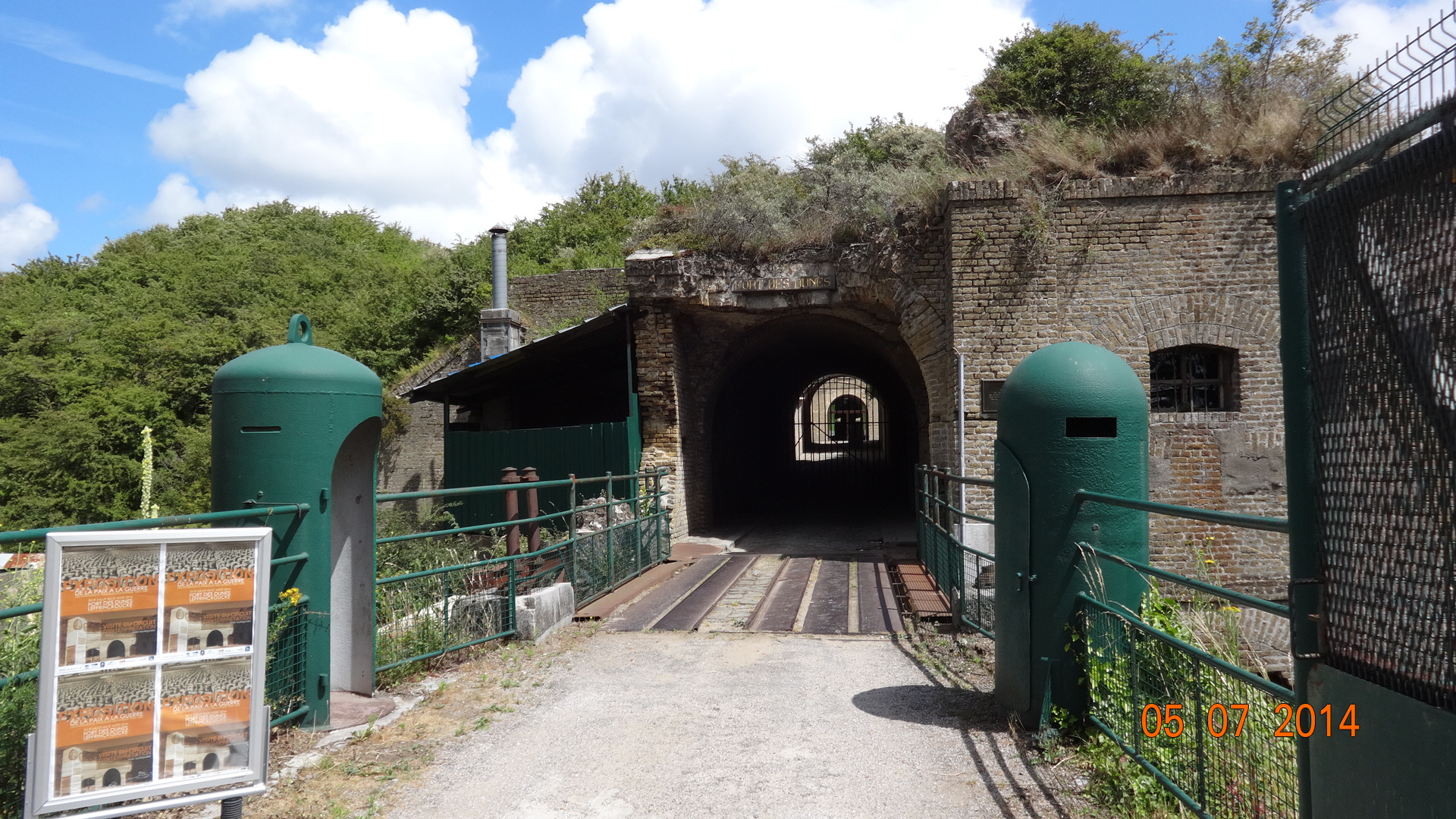
In the morning, we’re quickly through the Ardennes cross-country skiing areas and into the much flatter lands further north. We blink, and the signs have changed from French to Dutch (or Flemish?). We skirt the southern edge of Bruxelles before heading West across completely flat land, dotted with Friesian cows and farmhouses with red tiled roofs. We’re travelling fast on the now free, and very busy, motorways. In no time, we reach the coast and head South again to find the place we’d visited before at Zuydcote, near Dunkirk. It’s just over 11 months since we were here last (https://heidihymer.wordpress.com/2014/07/09/destintation-dunkerque/) and there’s been a few miles (aprox. 8510m / 13700km) under our wheels since then. How many of you, reading this, have done more than that driving backwards and forwards to work, I wonder?
Time to relax for a few days. We do some washing, buy a ticket back to the UK, and consider our next move….

endless sandy beach, backed by dunes at Zuydcoote


![DSC02059[1]](https://heidihymer.files.wordpress.com/2016/09/dsc020591.jpg?w=204&resize=204%2C153&h=153#038;h=153 "DSC02059[1]")


![DSC02062_1[1]](https://heidihymer.files.wordpress.com/2016/09/dsc02062_11.jpg?w=227&resize=227%2C171&h=171#038;h=171 "DSC02062_1[1]")
![DSC02060[1]](https://heidihymer.files.wordpress.com/2016/09/dsc020601.jpg?w=227&resize=227%2C170&h=170#038;h=170 "DSC02060[1]")


![DSC02081[1]](https://heidihymer.files.wordpress.com/2016/09/dsc020811.jpg?w=309&resize=309%2C231&h=231#038;h=231 "DSC02081[1]")
![DSC02084[1]](https://heidihymer.files.wordpress.com/2016/09/dsc020841.jpg?w=308&resize=308%2C231&h=231#038;h=231 "DSC02084[1]")

![DSC02097[1]](https://heidihymer.files.wordpress.com/2016/09/dsc020971.jpg?w=309&resize=309%2C231&h=231#038;h=231 "DSC02097[1]")


![DSC02110[1]](https://heidihymer.files.wordpress.com/2016/09/dsc021101.jpg?w=204&resize=204%2C153&h=153#038;h=153 "DSC02110[1]")
![DSC02102[1]](https://heidihymer.files.wordpress.com/2016/09/dsc021021.jpg?w=204&resize=204%2C153&h=153#038;h=153 "DSC02102[1]")


![DSC02139[1]](https://heidihymer.files.wordpress.com/2016/09/dsc021391.jpg?w=204&resize=204%2C153&h=153#038;h=153 "DSC02139[1]")